Looking for land near Lake Lanier sounds simple until you realize how much can change from one parcel to the next. Two properties with the same acreage in Cumming can offer very different options depending on access, zoning, utilities, and shoreline rules. If you are planning to build, hold, or buy for future use, this guide will help you focus on the details that matter most so you can move forward with more confidence. Let’s dive in.
Why Cumming acreage needs careful review
Buying land in Cumming and Forsyth County is different from buying an existing home. You are not just evaluating the view or the size of the lot. You are also checking whether the parcel has a usable building area, legal access, and the approvals needed for your plans.
Forsyth County updated its Unified Development Code on April 2, 2026. That means current zoning and subdivision rules should be treated as active, and each parcel should be verified on its own facts instead of relying on general assumptions about an area.
For land near Lake Lanier, you may be dealing with three separate layers of rules at once. Those can include county zoning and subdivision requirements, city or county utility service rules, and U.S. Army Corps of Engineers shoreline rules if the property touches the lake or adjacent public land.
Start with the parcel itself
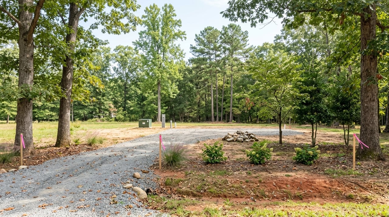
Before you think about house plans or future value, start with the land’s physical characteristics. Vacant land is typically reviewed based on size, location, accessibility, utility access, and comparable sales, but land near water, wetlands, rights of way, and rural tracts often needs extra analysis.
In Cumming, some of the most important first-pass checks are practical ones. You will want to look at road frontage or legal access, slope, drainage, tree cover, visible easements, and whether the parcel still has a clear building envelope after setbacks and buffers are applied.
Forsyth County GIS can help you screen a property and review topographic information. Still, the county states that GIS maps are not a legal survey and cannot certify boundaries, so they are useful for research but not for final boundary decisions.
Access matters more than many buyers expect
Access can make or break a land purchase. If a tract is being split or combined, Forsyth County subdivision rules require ingress and egress easements for divided tracts.
You should also confirm whether the road is public or private. Forsyth County notes that private streets are privately maintained, which can affect your ongoing obligations and the way you evaluate the property.
A buildable area is not the same as total acreage
A larger parcel does not always mean more usable land. Slope, drainage patterns, easements, setbacks, and buffers can reduce where a home, driveway, or other improvements may actually fit.
That is why two parcels with the same acreage can have very different value. One may have a clean, straightforward building site, while another may need additional survey work, easement review, or site planning before it is ready.
Check utilities early
Utilities are one of the biggest factors in land feasibility near Cumming. In Forsyth County residential districts, public water is generally available more often than public sewer, and some districts rely on septic systems.
The county code notes that Res1 and Res2 districts are generally served by public water, while public sanitary sewer is generally not available. It also notes that Res2 lot sizing is often tied to septic drain field needs.
Water service may vary by provider
It is important to verify who serves the parcel. Cumming Utilities states that sewer service is available only to a limited number of customers and may not be available everywhere.
In some parts of the city service area, gravity sewer may be available. In other locations, a grinder pump may be required. Forsyth County’s water main map also excludes the City of Cumming water service area, so you should confirm the correct utility system for the specific property.
Septic approval can affect your timeline
If the parcel will use septic, Forsyth County Environmental Health issues onsite sewage permits and performs final inspections. Approval is required before a building permit can be issued for work on a septic-served property.
The county also says septic applications can take 20 business days or more to process. If you are trying to line up design, budgeting, and construction timing, that review period matters.
Well requirements need planning too
If a private well may be needed, Georgia DPH has setback requirements for well locations in relation to septic tanks, absorption fields, sewer lines, and animal enclosures. Wells must also be installed by a licensed water-well contractor who notifies the county health department before drilling.
Georgia DPH also recommends annual bacterial testing and a chemical screen every three years. For buyers considering more rural acreage, that is an important part of long-term planning and maintenance.
Understand zoning and overlays
Zoning tells you the base rules for a parcel, but it may not tell the whole story. Forsyth County’s zoning map includes districts such as A1 Agricultural, Ag RES Agricultural Residential, LR Lake Residential, and several residential, commercial, industrial, and mixed-use categories.
The county also maps overlay districts, including protected water supply watershed, groundwater recharge area, wetland protection, and the North Georgia 400 overlay. These overlays matter because they can add rules beyond the base zoning.
Overlays can override the base zoning
Forsyth County’s mapping notes state that overlay regulations apply in addition to the underlying zoning. If there is a conflict, the overlay standards control.
For you as a buyer, that means a parcel that looks straightforward on the zoning map may still face added restrictions if it is near wetlands, streams, or certain corridors. It is one of the biggest reasons land due diligence should be parcel-specific.
Subdivision status matters for acreage deals
Forsyth County’s subdivision and land development chapter applies to all real property in unincorporated Forsyth County. The code states that no person may sell or offer to sell any parcel that has not been subdivided under the chapter’s requirements.
For major and minor subdivisions, final plat approval is required, and utility construction must be approved before the final plat can be recorded. If you are buying acreage that may be split, assembled, or improved later, this is a major point to confirm upfront.
Lake Lanier adds another layer
If the land touches Lake Lanier or nearby public shoreline areas, county rules are only part of the picture. The U.S. Army Corps of Engineers manages public use of the lake and handles shoreline permits for docks, riprap, and small silt removal on public lands.
The Corps states that shoreline use permits and licenses are nontransferable, last a maximum of five years, and do not create real estate rights. In plain terms, shoreline use is not something you should assume transfers automatically with the deed.
Dock and shoreline rights need separate verification
Only certain property owners adjacent to public lands zoned limited development may apply for a shoreline use permit or license. Any work on public property requires Corps approval first.
The Corps also lists activities like clearing vegetation or placing non-permitted items on public property as prohibited without authorization. If lake access is part of why you are buying, verify permit status and shoreline rules separately from county zoning and the deed.
Lake frontage does not always mean the same thing
Around Lake Lanier, market value often depends on usability rather than just the number of acres. A parcel with legal access, utility availability, and a clean build site may be much more valuable than another parcel of similar size that needs septic approval, survey work, easement clarification, or shoreline permission.
That is one reason land near the lake can be harder to price than a platted subdivision lot. The market is valuing a site with unique physical and regulatory characteristics, not a finished house with easy one-to-one comparisons.
A practical land-buying checklist
If you are evaluating land or acreage in Cumming near Lake Lanier, focus on these items early:
- Confirm the parcel’s zoning district and any overlay districts
- Verify legal road access, frontage, or recorded access easements
- Check whether the road is public or privately maintained
- Review topography, drainage, tree cover, and visible easements
- Identify the likely building envelope after setbacks and buffers
- Confirm whether water service is available and by which provider
- Verify whether sewer is available, limited, or not available
- If septic is needed, confirm permit feasibility with Forsyth County Environmental Health
- If a well may be needed, review Georgia DPH setback requirements
- If the parcel touches Lake Lanier, verify Corps shoreline permit status separately
- Use GIS for screening, but rely on a licensed surveyor for certified boundaries
How this helps you buy smarter
Land can offer flexibility, privacy, and long-term upside, but only if the parcel truly supports your goals. The smartest buyers near Cumming and Lake Lanier start with the basics, then work outward from access, utilities, zoning, and shoreline rules before they get attached to a specific homesite.
That process may feel more detailed than buying an existing home, but it can save time, money, and frustration later. When you know what to verify and in what order, you can compare acreage opportunities more clearly and make decisions with fewer surprises.
If you are exploring land, custom-home sites, or acreage near Cumming and Lake Lanier, Hollingsworth Company can help you evaluate parcel details, compare opportunities, and move forward with clear local guidance.
FAQs
What should you verify first when buying land in Cumming, GA?
- Start with zoning, legal access, topography, utility availability, and whether the parcel has a clear building envelope after setbacks and buffers.
Can you rely on Forsyth County GIS maps for exact property boundaries?
- No. Forsyth County states that GIS maps are not a legal survey, and a licensed surveyor is required to certify boundaries.
Is sewer available on all land parcels near Cumming and Lake Lanier?
- No. Cumming Utilities says sewer service is available only to a limited number of customers and may not be available in every location.
Do Lake Lanier dock rights transfer automatically with a land purchase?
- No. The U.S. Army Corps of Engineers states that shoreline permits are nontransferable and do not convey real estate rights.
What happens if a Cumming land parcel needs septic approval?
- Forsyth County Environmental Health must issue the onsite sewage permit and complete final inspection, and the county says septic applications can take 20 business days or more to process.
Why can two Lake Lanier acreage parcels have very different values?
- Parcel value can change based on legal access, utility service, buildability, easements, septic feasibility, and shoreline permissions, even when the acreage is similar.